

Results 1 to 1 of 1
Thread Information
Users Browsing this Thread
There are currently 1 users browsing this thread. (0 members and 1 guests)
 LinkBack URL
 About LinkBacks
Hybrid View


-
08-17-2015, 05:52 PM #1Senior Member


- Join Date
- Aug 2008
- Location
- PARADISE (San Diego)
- Posts
- 99,038
Note to politicians: This is what the U.S.-Mexican border really looks like
Note to politicians: This is what the U.S.-Mexican border really looks like
By John Boyd
Published 3:51 pm, Monday, August 17, 2015
Photo: US Customs And Border Protection
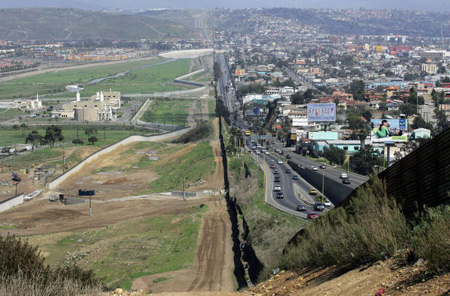
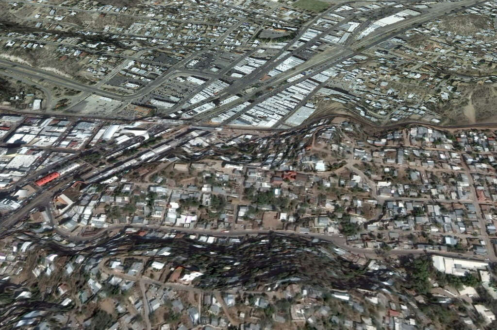
Eagle Pass, Texas
During the Mexican-American War, the U.S. government established Camp Eagle Pass as a militia outpost to protect Texas from Mexican forces. More than 150 years later, the same government had to sue the city of Eagle Pass in 2008 in order to turn over land to build a border fence through the town. Today, some of the city's finest homes enjoy Rio Grande River views.
IMAGE 1 OF 15
Photo: Google Earth
IMAGE 2 OF 15
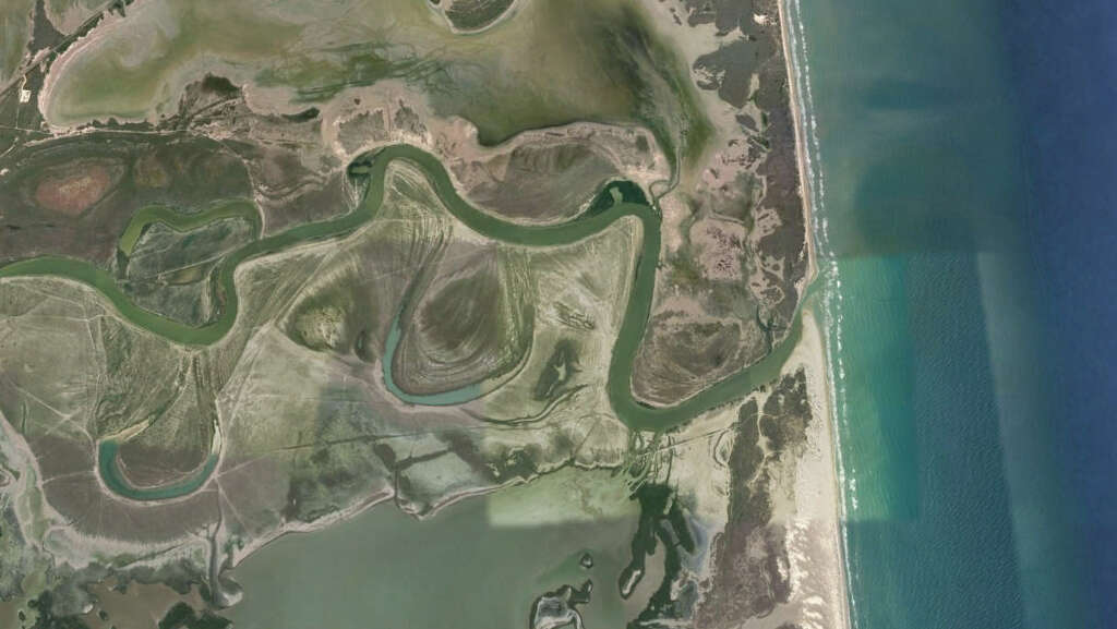
Las Palomas Wildlife Management Area, Texas
Near Brownsville, Texas, this protect wildlife area buffers the Gulf of Mexico as the border's most eastern point. The area serves as rich nesting habitats and wetlands for birds on both sides of the border.
Photo: Google Earth
IMAGE 3 OF 15
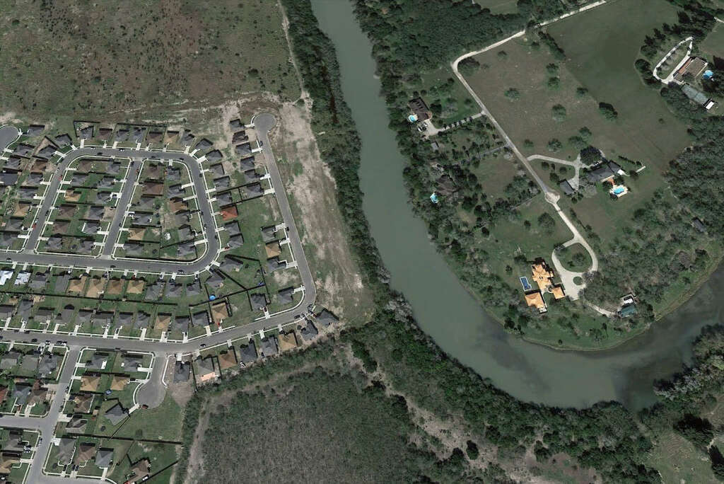
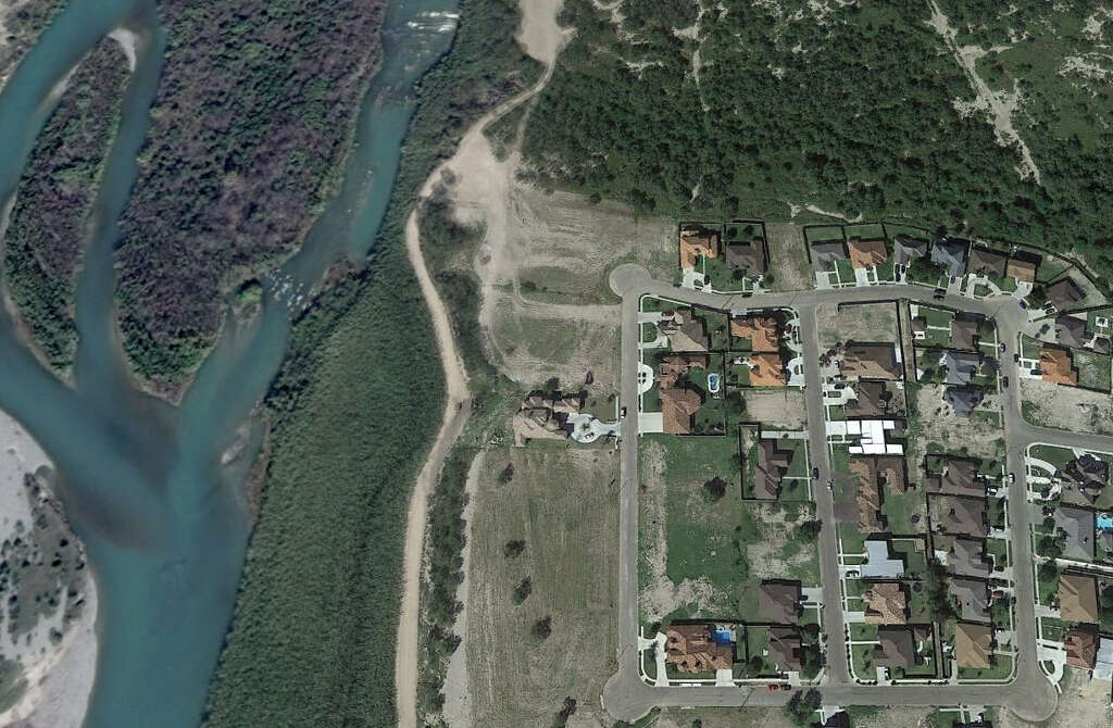
Brownsville, Texas - Matamoros, Mexico
Well cared-for homes with backyard pools are sought after features for homebuyers on both sides of the Texas-Mexico border.
Photo: Google Earth
IMAGE 4 OF 15
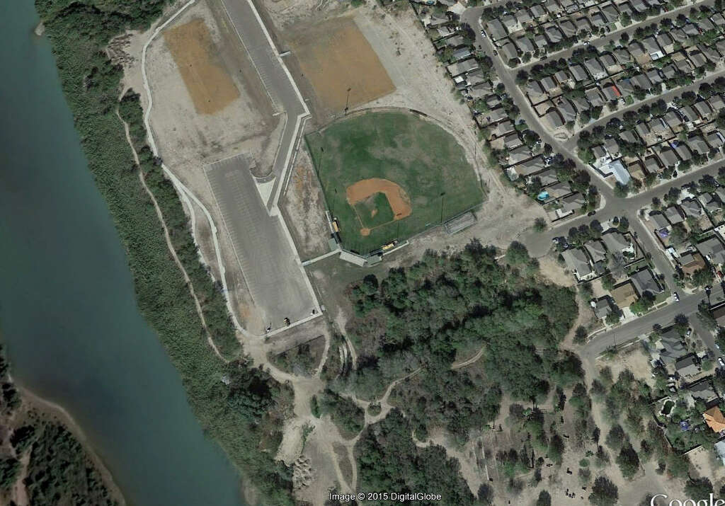
Laredo, Texas
The city of Laredo has not one, but two, baseball parks overlooking the Rio Grande and Nuevo Laredo on its western shore: the community-friendly Father Charles M. McNaboe Park seen here and the Anna Baseball Park to its south. A school ballpark also sits near the river.
Photo: Google Earth
IMAGE 5 OF 15
Heroic Nogales, Mexico - Nogales, Arizona
At more than 10 times the population of its northern neighbor of a similar name Heroic Nogales certainly does look like quite the superpower.
Photo: Google Earth
IMAGE 6 OF 15
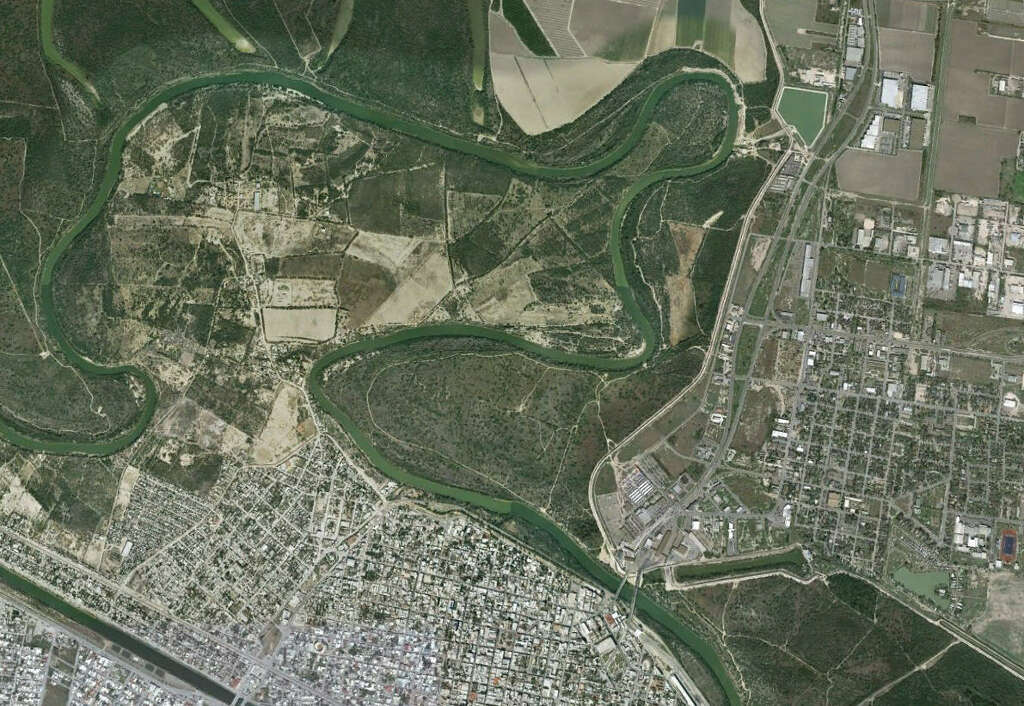
Hidalgo, Texas - Reynosa, Mexico: Few borders are a straight line, but here the winding Rio Grande border makes a peninsula for all practical purposes out of Renyosa, Mexico.
Photo: Google Earth
IMAGE 7 OF 15
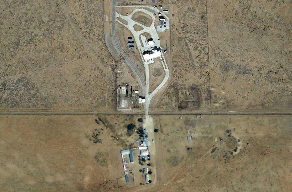
Antelope Wells, New Mexico - El Berrendo, Mexico
The only residents of Antelope Wells, New Mexico are the U.S. Customs and Border Protection agents who protect the smallest of 43 border entry points along the U.S.-Mexico border.
Photo: Google Earth
IMAGE 8 OF 15
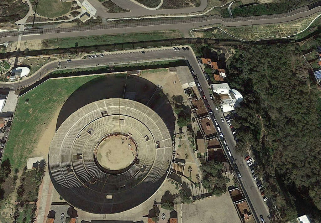
Plaza Monumental de Tijuana, Tijuana, Mexico
The "Bullring by the City" hosts more than 21,000 for regular bullfights, and sits less than 200 feet from the California border.
Photo: Google Earth
IMAGE 9 OF 15
Eagle Pass, Texas
During the Mexican-American War, the U.S. government established Camp Eagle Pass as a militia outpost to protect Texas from Mexican forces. More than 150 years later, the same government had to sue the city of Eagle Pass in 2008 in order to turn over land to build a border fence through the town. Today, some of the city's finest homes enjoy Rio Grande River views.
Photo: Google Earth
IMAGE 10 OF 15
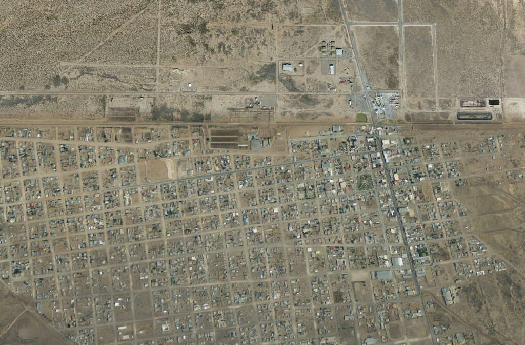
Puerto Palomas, Mexico
From above, the distinction between Puerto Palomas and tony Columbus, New Mexico is nearly unrecognizable.
Photo: Google Earth
IMAGE 11 OF 15
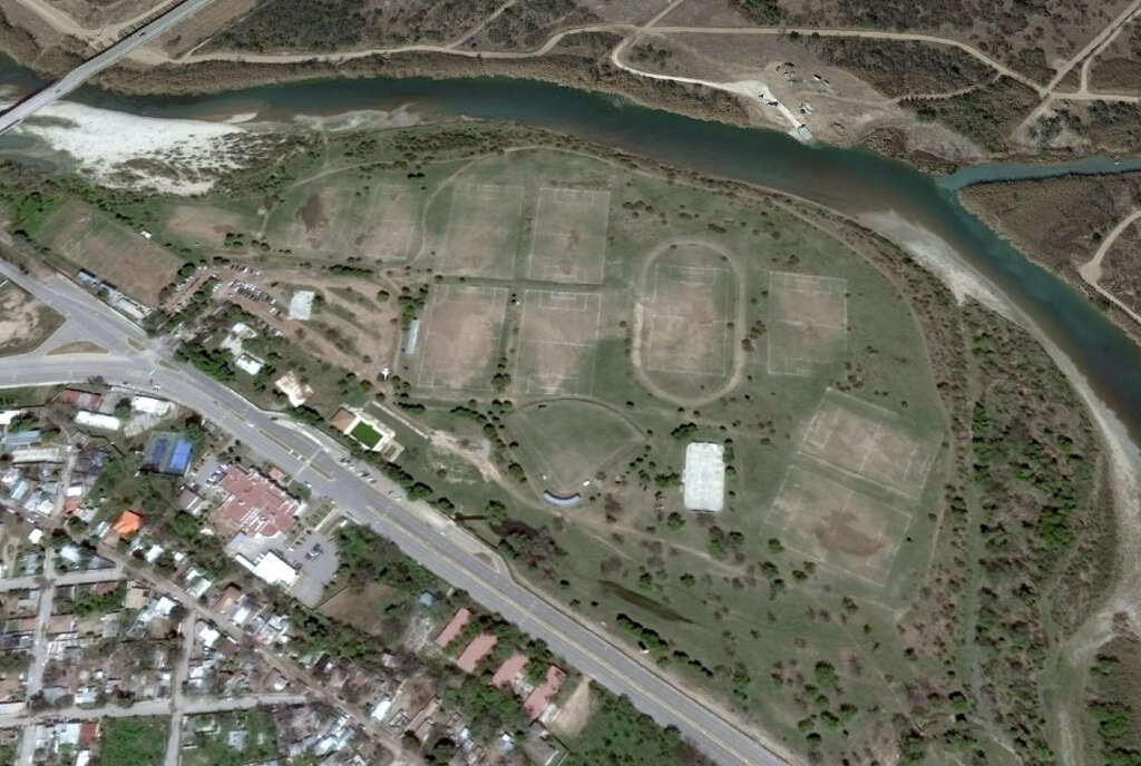
Ciudad Acuna, Mexico
Youth sports fields sit waterside on the Rio Grande near Del Rio, Texas.
Photo: Google Earth
IMAGE 12 OF 15
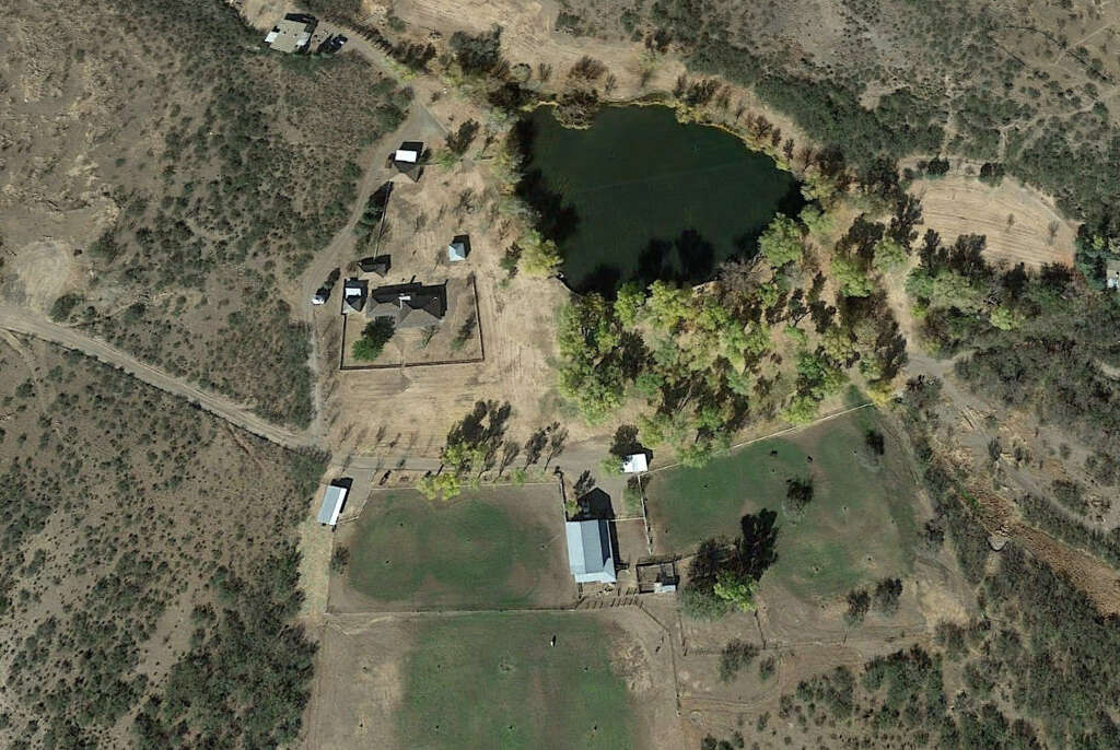
Slaughter Ranch, Arizona
Located outside Douglas, Arizona, the Douglas Ranch overlooks the Mexican border and charges visitors $5 to tour its grounds and learn about legendary lawman "Texas" John Slaughter
Photo: Google Earth
IMAGE 13 OF 15
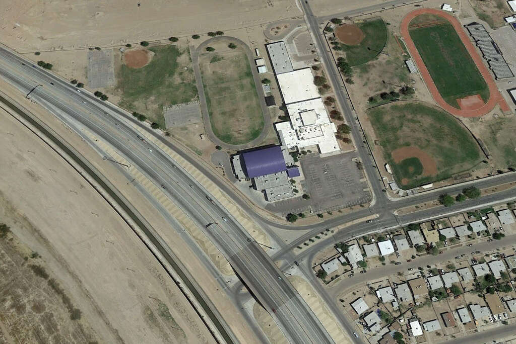
Riverside Middle School, El Paso, Texas
On the corner of Midway Drive and Cesar E. Chavez Border Highway sits this middle school, home to the Riverside Rebels. The high school's baseball and football stadium's sit just east; Ciudad Juarez, Mexico sits just west.
Photo: Google Earth
IMAGE 14 OF 15
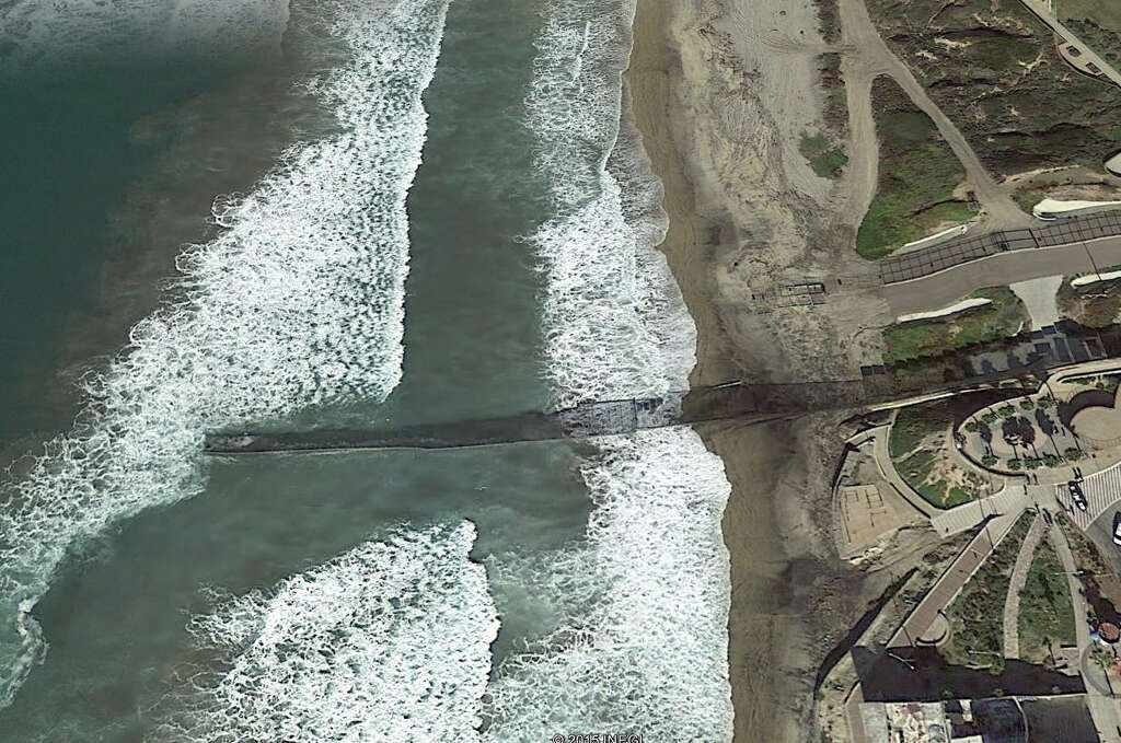
Chula Vista, California Tijuana, Baja, Mexico
The international fenceline separating the two cities stretches out into the surf of the Pacific Ocean.
What the U.S./Mexican border really looks like
While the border is often depicted as a desert wasteland filled cacti and rattlesnakes, in many cases the border resembles a neighborhood much like any other: some nice houses on one side of a street, some more nice houses on the other side of the street. See some of the more interesting cross-border pairings between the neighboring countries.
While some politicians like to paint a picture of the U.S.-Mexican border as a pre-militarized zone waiting for a wall and a soldier to keep it safe, there's at least one problem with sticking the world's second Great Wall on the border to prevent immigration.
Namely, the swimming pools.
While the border is often depicted as a desert wasteland filled cacti and rattlesnakes, in many cases the border resembles a neighborhood much like any other: some nice houses on one side of a street, some more nice houses on the other side of the street.
See some of the more interesting cross-border pairings between the neighboring countries in the gallery above.
http://www.chron.com/news/politics/a...ks-6448797.php
NO AMNESTY
Don't reward the criminal actions of millions of illegal aliens by giving them citizenship.
Sign in and post comments here.
Please support our fight against illegal immigration by joining ALIPAC's email alerts here https://eepurl.com/cktGTn


 Reply With Quote
Similar Threads
-
Note to ATF: When you give guns to Mexican Cartels, they use
By AirborneSapper7 in forum General DiscussionReplies: 0Last Post: 05-11-2011, 03:14 PM -
Mexican politicians want to get the US out of Mexico
By JohnDoe2 in forum illegal immigration News Stories & ReportsReplies: 1Last Post: 09-15-2010, 01:00 AM -
Mexican army detonates small bomb found with note
By JohnDoe2 in forum illegal immigration News Stories & ReportsReplies: 0Last Post: 02-27-2010, 01:20 AM -
Message to Politicians Running in 2006: Today We Note, Tomor
By swtncgram in forum General DiscussionReplies: 0Last Post: 05-22-2006, 11:12 AM -
Note from US Border Control
By moosetracks in forum General DiscussionReplies: 6Last Post: 05-02-2006, 08:56 PM


Senator Rick Scott Weighs in on the SAVE America Act The Only...
04-19-2026, 05:08 PM in Non-Citizen & illegal migrant voters