

Results 1 to 2 of 2
Thread: The era of the Superstorm
Thread Information
Users Browsing this Thread
There are currently 1 users browsing this thread. (0 members and 1 guests)
 LinkBack URL
 About LinkBacks
-
01-04-2013, 07:26 PM #1Senior Member


- Join Date
- Aug 2008
- Location
- PARADISE (San Diego)
- Posts
- 99,040
The era of the Superstorm
The era of the Superstorm
By Tricia Escobedo, CNN
updated 4:53 PM EST, Fri January 4, 2013
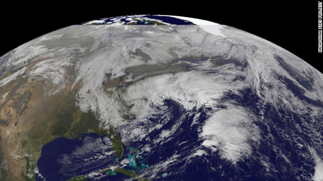
More than one week after Superstorm Sandy hit, the Northeast prepares for a nor'easter, a strong low pressure system with powerful northeasterly winds coming from the ocean ahead of a storm. This satellite image captured at 11:01 a.m. ET on Friday, November 9, shows the winter storm over the East Coast. See photos of the aftermath of Superstorm Sandy.
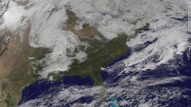
This satellite image captured at 9:15 a.m. ET on Wednesday, November 7, shows the winter storm.
This satellite image shows the storm at 11 a.m. on Monday, November 5. NOAA predicts the system will travel northward paralleling the U.S. East Coast by Wednesday morning.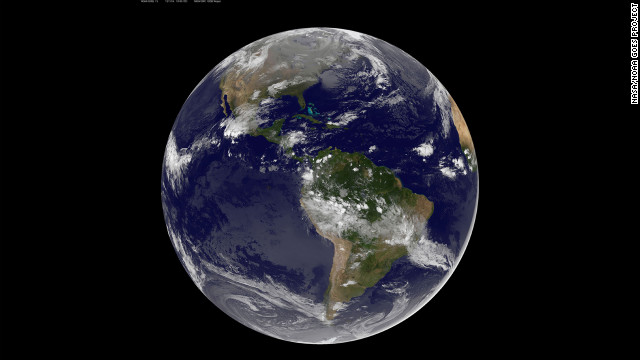
The Western Hemisphere was relatively calm on Sunday, November 4, at 12:45 a.m. ET.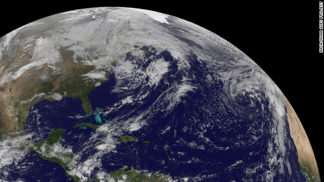
The eastern U.S. was still coping with the aftermath of Sandy at 8 a.m. on Friday, November 2.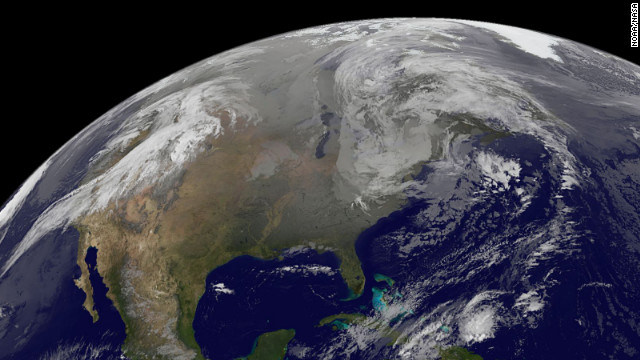 Superstorm Sandy was just a low pressure area at 5 a.m. on Thursday, November 1.
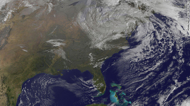
The Northeast Corridor slowly struggled back to life on Wednesday after the knockout punch from Superstorm Sandy. This image shows the storm at 9:10 a.m. ET on Wednesday, October 31.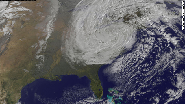
The destruction caused by Superstorm Sandy mounted Tuesday morning as electrical fires and record power outages added to the misery of devastating flooding in the Northeast. This image shows the storm at 9:40 a.m. ET on Tuesday, October 30.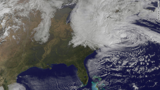 Superstorm Sandy officially made landfall Monday evening along the coast of southern New Jersey, the National Hurricane Center reported. This image shows the storm at 7:40 p.m. ET.
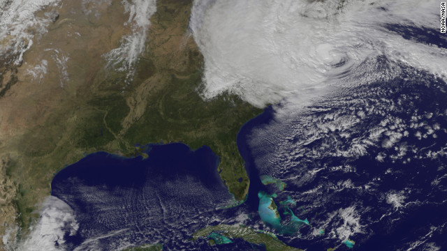
This satellite image shows Hurricane Sandy at 2:59 p.m. ET on Monday, October 29. The storm, which threatens 60 million people in the eastern third of the United States, is expected to bring days of rain, high winds and possibly heavy snow.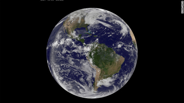
A satellite image of the Western Hemisphere shows Hurricane Sandy's massive size at 2:22 p.m. on Monday, October 29.On CNN TV: Superstorms are a new breed of weather that put lives and cities that were once protected in the eye of their fury. Are we ready for the next one? Watch CNN's "The Coming Storms" on Saturday, January 6, at 8 p.m. and 11 p.m. ET.
(CNN) -- They hover above our heads, out of sight, zooming in and taking pictures.
They aren't interested in the latest celebrity wedding or covert military operation. And the images they take aren't going to make the front page of any magazine or website.
But maybe they should.
That's because the data collected by these powerful satellites have helped save countless lives by allowing meteorologists to warn people about dangerous storms -- sometimes a week before they strike -- with pinpoint accuracy.
Seven days before Superstorm Sandy hit the United States on October 29, computer models based on the data from these satellites predicted the storm would make landfall in New Jersey.
It landed just five miles from where the earliest forecasts said it would.
"It is unprecedented," said Chad Myers, CNN's severe weather expert and meteorologist. "(No) other storm in recent memory has been forecast that good for that long.

Obama: Focus on jobs, not climate change
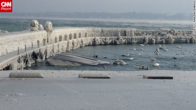 Low temperatures in Switzerland helped freeze Lake Geneva in early February. Rita Rautenbach got this amazing shot at the time. "'During the night and the day before, we had extreme temperatures where it got so cold that the spray made waves on the lake. As it sprays up it turns into ice immediately. It became layer on layer on layer. It became thick blocks of ice on the bench, on the cars."
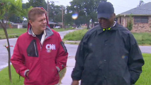
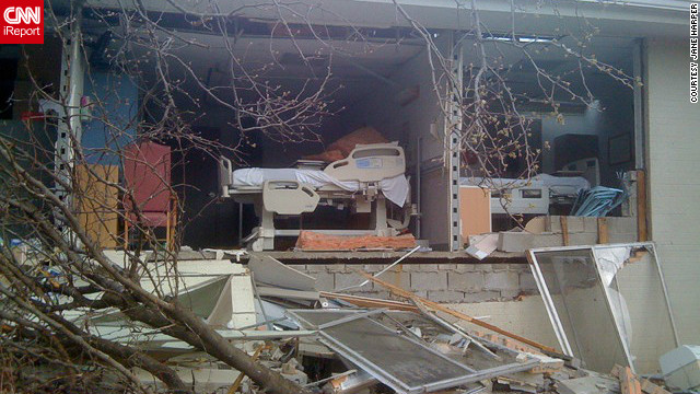 Hospital rooms were completely destroyed after a tornado hit Harrisburg, Illinois in February. Jane Harper, a nurse there, took this photo after moving patients out of harm's way. She went to check one of the patient rooms, and found that the room was no longer there.
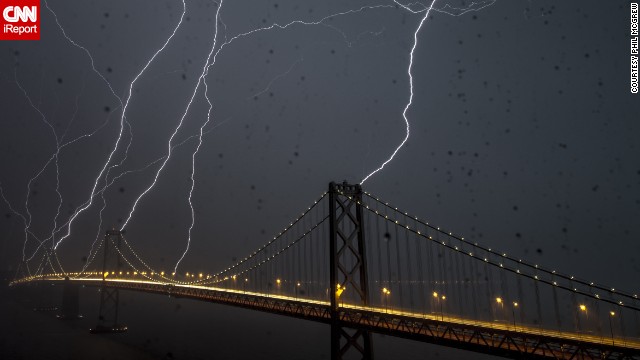 A lightning storm lit up the Bay Bridge in San Francisco, California in April. Phil McGrew shot 20-second exposures for 90 minutes in order to get shots like this.
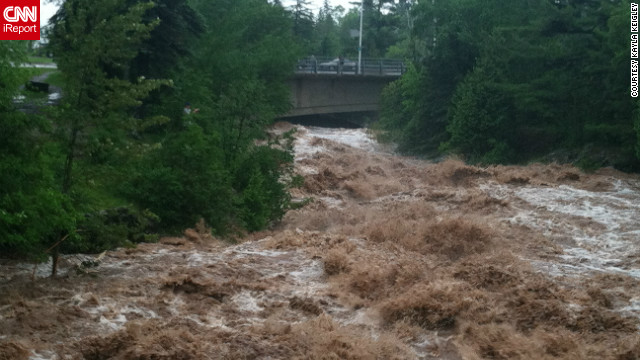 Severe flooding in Duluth, Minnesota, in June destroyed roads and left neighborhoods underwater. "We have not experienced anything like this in our community," said photographer and healthcare preparedness coordinator Kayla Keigley. "Roads are destroyed. Neighborhoods are underwater. I am in shock and I work in the field of preparedness - this is something I work to deal with daily. Our community is in disbelief."
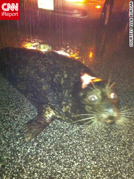
A stranded seal sat on a Duluth, Minnesota, roadway after it was washed out of the Lake Superior Zoo during the June flooding. This image, shot by Ellie Burcar - who discovered the seal - went viral. Authorities soon arrived and the seal survived the ordeal.
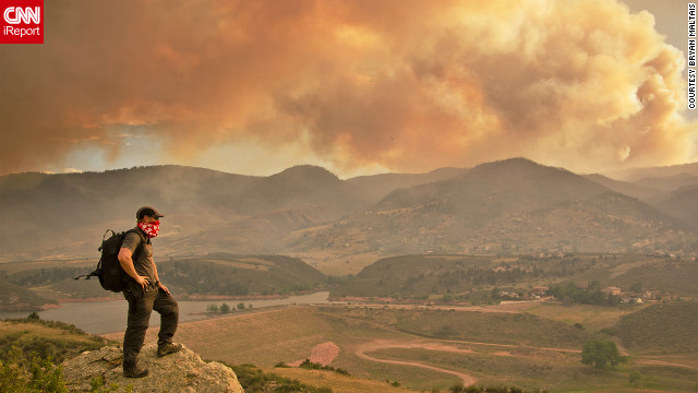 June's High Park fire, caused by extreme drought conditions, could be seen from the Horsetooth Reservoir in Larimer County, Colorado. "Climbing to this vantage point afforded me the opportunity to capture the fire crew on film at eye level as they flew by, and to look down into the heliport," said Bryan Maltais. "I could also also photograph the unique atmospheric conditions that the fire created."
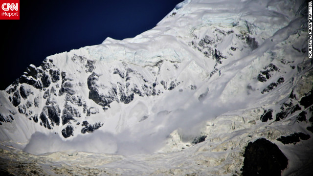 An avalanche tumbled down the surrounding mountains of the Annapurna Base Camp in Nepal in June. After hiking for more than a week in the Himalayas, J. Grant Trammell decided to shoot some photos from the safety of base camp. "It was a magically clear and still morning. I awoke just at 4 a.m. I made my way to a vantage point just above the Annapurna Base Camp and shot images for almost five hours."
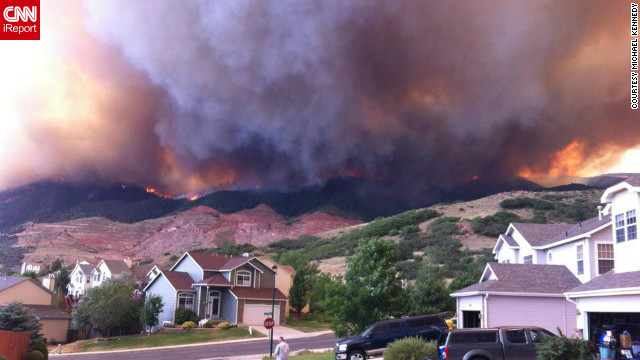 Wildfires burning in the foothills of the Colorado Springs mountains blanketed a nearby neighborhood with pitch-black smoke in June. "We ran outside and saw the side of the foothills getting engulfed by flames coming down on either sides of the quarry," said photographer Michael Kennedy. "Our subdivision quickly deteriorated into a war zone with police cars coming into the neighborhood with loud speakers announcing 'leave the area, under mandatory evacuation.'"
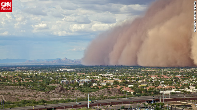 A massive haboob, or dust storm, overtook Phoenix, Arizona in July, and Andrew Pielage knew he had to get it on camera. Racing up a mountain that was nearby, he skipped the official trail to get a better view and was able to capture it from a very unique angle. "I had made it just in time. You really get a good and scary sense of the size and magnitude of these types of storms. It will be a photograph I will never forget."
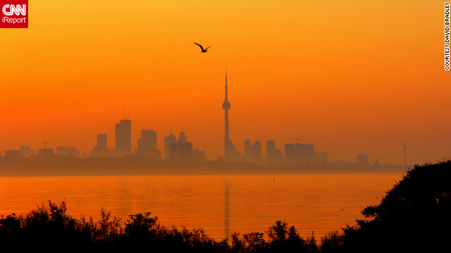 Searing temperatures and high humidity brought a heat wave to Toronto, Canada, in July. "These past days have been brutal with the heat, the humidity. Tempers are short, electricity system is straining but not buckling... yet," photographer David Bradley told us at the time.
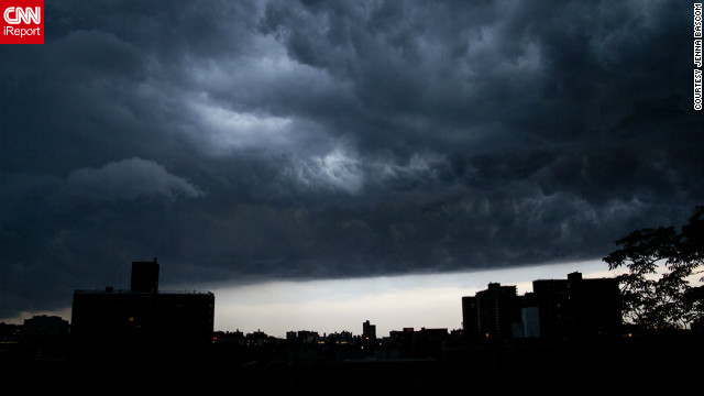 Skies darkened over New York City as a storm moved into the area in July. "The storm was pretty mild, but seeing it come through was amazing," said photographer Jenna Bascom at the time. "Gorgeous clouds, great light."
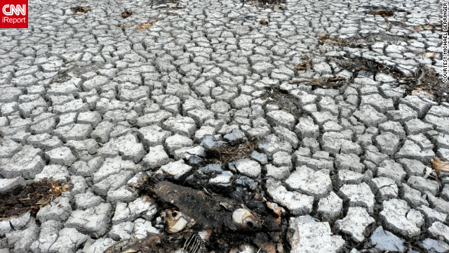 A historic drought in Terre Haute, Indiana, dried up a lake at the Wabashiki Fish and Wildlife Area, killing the fish living in it back in July. At the time, photographer Michael Gerringer said, "This lake attracts an impressive variety of birds and other wildlife, but when I walked out into the lake bed the only bird species I saw were a pair of turkey vultures overhead and a few red-headed Woodpeckers."
Hurricane Isaac brought flooding to the streets of Fort Pierce, Florida in August. Trish Powers described the water as "waist deep" at times. See more Isaac images here.
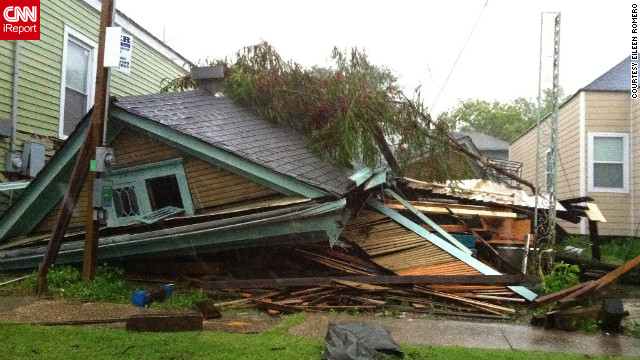 Many homes like this one collapsed in New Orleans, Louisiana after Hurricane Isaac hit in August. Eileen Romero was completely shocked when she came upon the scene only a block away from her home in New Orleans' Mid-City neighborhood.
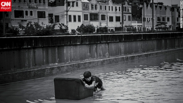 Dramatic flooding hit low-lying parts of Manila, Philippines, in August after continuous rainfall. Grant Orbeta captured stunning images like this one.
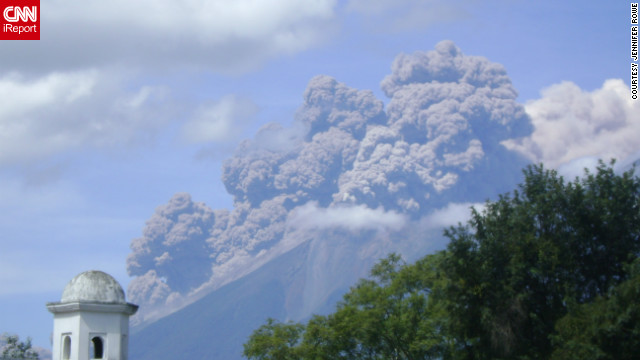 Fuego Volcano spewed ash into the air in Antigua, Guatemala, shortly after it erupted in September. Photographer Jennifer Rowe said, "People who have lived here for more than 20 years have told me this is the biggest eruption they've ever seen."
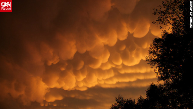 Rare cloud formations, called mammatus, were spotted in La Crosse, Wisconsin in September. The name "mammatus" comes from the Latin word manna, or breast. "After the storms rumbled through, I saw a yellow orange glow out the window," said Jim Jorstad. "I then grabbed my camera, began driving several miles up the hill, stopping to take photos along the way."
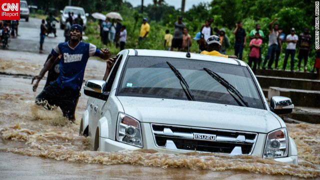 Santo Domingo, Dominican Republic faced large-scale flooding as it was hit with Hurricane Sandy prior to the U.S. in October. Misael Rincon shot images of the superstorm and other hurricanes in 2012.
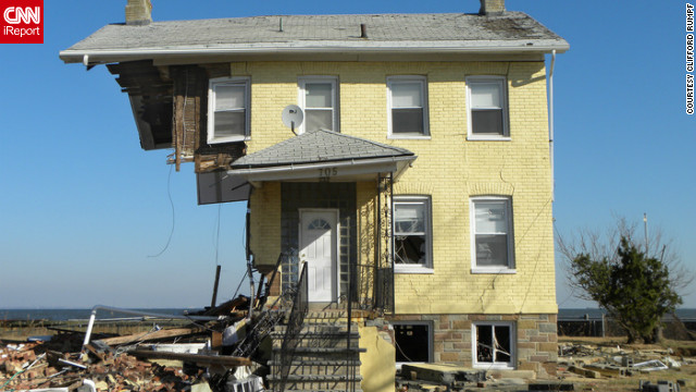 A house in Union Beach, New Jersey, was left standing despite being ripped apart from the winds of Superstorm Sandy in October. While photographing the area, Clifford Rumpf said each photo taken of the ravaged neighborhood was more shocking than the next. See more Sandy images here.
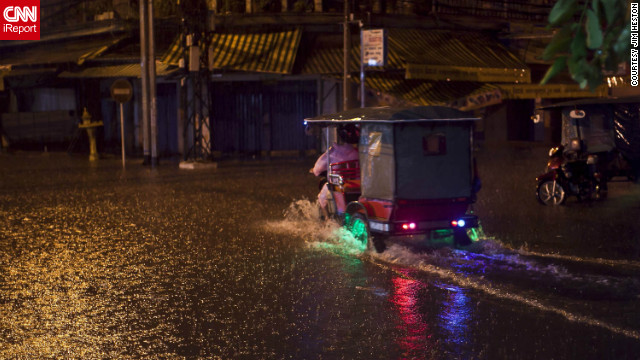 Phnom Penh, Cambodia was hit with a torrential downpour of rain in October, causing flash flooding. Jim Heston was in awe of the fact that his camera was able to capture falling rain as well as it did.
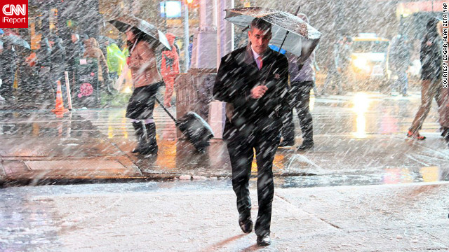 A nor'easter blew through Manhattan in November just after the area was hit by Superstorm Sandy, but a number of New Yorkers continued with business as usual. "I immediately rushed outside with my camera to capture some images, and, as the snowfall got heavier, I ended up walking from Upper East Side, down Fifth Avenue, to Times Square, taking snapshots of the snow bearing down on people and blanketing the streets," said Edgar Alan Zeta Yap.
"We knew days in advance, much more in advance, 48 hours in advance more than we knew in Katrina (in 2005)."
It could have been a much different story.
A month before the 1,000-mile-wide storm struck the Northeast, at the height of the hurricane season, the geostationary satellite that monitors the Caribbean and Atlantic -- where Sandy gathered strength -- stopped working. While there are dozens of American weather satellites in orbit, these geostationary spacecraft are crucial to predicting dangerous weather patterns.
America's aging satellites
Luckily, the National Oceanic and Atmospheric Administration, or NOAA, had a backup satellite to scramble into place. Without it, the early warning for Sandy's impending strike on the northeast might not have been as accurate.
That close call has meteorologists worried that, in this era of shrinking budgets, aging satellites might not get the expensive repairs they need to operate, and NOAA might not be able to purchase backup satellites.
Satellites like these are expensive -- $1 billion each -- and they take five years to build and launch.
Compare that to the cost of major storms, like Sandy which is estimated to have inflicted nearly $80 billion in damage in New York and New Jersey alone. Not to mention the cost in human lives.
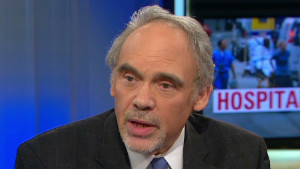
"If there's a major failure of the satellites, that would be a major disaster and indeed we would be blinded in many respects," explained Kevin Trenberth, who heads climate analysis at the National Center for Atmospheric Research.
"We would not be able to see what's going on in the Earth's system as well as we can now."
Scientists can only wonder how many lives this technology could have saved on September 8, 1900, when a Category 4 hurricane slammed into Galveston, Texas, with no warning, killing at least 8,000 people. It would be another 70 years before satellites were used in weather forecasting.
Opinion: More voices needed in climate debate
A major failure of these satellites could pose a serious threat as climatologists and meteorologists warn that storms like Sandy could become more frequent and more powerful in the near future.
Lessons from Katrina
Seven years ago, the only thing protecting the low-lying city of New Orleans from a massive storm surge was an inadequate and outdated system of levees and floodwalls.
Lessons from Katrina and Sandy
Katrina memories haunt New Orleans

Looking back at Hurricane Katrina
After Hurricane Katrina slammed into the U.S. Gulf Coast in 2005 -- killing 1,800 people and inflicting $100 billion in damage -- Congress said never again.
Federal lawmakers spent $14.5 billion, mostly federal funds, to build a fortress around New Orleans.
Today the city is protected by 350 miles of stronger levees and higher flood walls that form a circle around New Orleans to keep any deadly storm surges at bay.
Among its most powerful new weapons: the largest storm-surge barrier in the world.
The massive barrier wall extends nearly 200 feet into the earth, and towers 26 feet above the water. It's reinforced by350,000 tons of steel -- 50 times the amount in the Eiffel Tower.
The fortress has turned New Orleans into a giant bathtub. To prevent that bathtub from filling up during a major storm, the city built the world's largest water pumping system.
"(One station) can pump about 30,000 cubic feet of water per second, which is just extraordinary," said Garrett Graves, who is overseeing the state's new hurricane protection plan.
At that rate, Graves explained, each of the 77 pumping stations could "fill an
Olympic size swimming pool in about 4½ seconds."
It's arguably the best hurricane protection system in the country -- but Malcolm Bowman hopes it won't be for long.
That's because Bowman wants to build a barrier system across the 5-mile-wide opening to New York Harbor that he says could have protected America's most populated city from Sandy's devastating storm surge.
"If barriers and sand dunes had been properly built in the last eight years, none of this would have happened," he said.
Bowman leads the Storm Surge Research Group at Long Island's Stony Brook University. The group promotes a plan to create an elaborate system of barriers and causeways that would virtually flood-proof much of metro New York.
They say their "Outer Harbor Gateway" plan would cost billions of dollars less than the damage that Sandy inflicted upon the state of New York.
Bowman has spent years warning officials of the storm surge risk to New York City.
Less than a month after Katrina, he wrote an op-ed in the New York Times warning that the same thing could happen to New York City -- and outlining his storm barrier system solution to prevent it from happening.
He tried again in 2008 as part of a climate change panel convened by New York City's Mayor Michael Bloomberg.
But no barriers were built.
Today, Bowman is hopeful that New York authorities will green-light his plan.
Gov. Andrew Cuomo is awaiting recommendations from a commission that he tasked with finding long-term solutions to protect his state from future weather calamities.
Two commissions on disaster preparedness and response have already offered their recommendations to the governor, who is expected to announce several proposals during his "state of the state" address on Wednesday.
Bowman's idea is not new: Similar barriers already exist in Stamford, Connecticut, and Providence, Rhode Island, and massive barriers are already in operation in the Netherlands and Russia.
With the rising sea levels -- a result of the shrinking polar ice cap -- experts including Bowman say the risk of massive flooding events is increasing each year -- and not just in low-lying communities like New Orleans.
"We have to start planning," Bowman said. "It's no longer every person for themselves. There's too much at risk. We have to do it."
The polar problem
Over the past 20 years, the global sea level has risen more than two inches as a result of Greenland's shrinking ice masses, according to Dr. Kevin Tremberth with the National Center for Atmospheric Research. That's because warmer temperatures are melting the polar ice caps.
Scientists map Antarctic sea ice
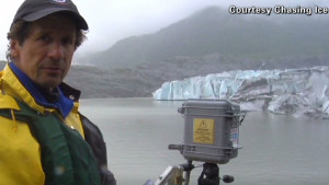
Photographer captures glacial retreat
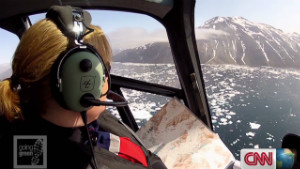
Icebergs change Greenland's habitat
Recent satellite images from NASA showed unprecedented surface ice melt, with about 97% of Greenland's ice sheet showing signs of thawing.
These changes in the polar region are closely monitored by climate scientists, like Daniel Steinhage, whose team surveyed Greenland's shrinking ice with Polar 6 one of the most advanced research aircraft in the world. It will take months to evaluate the data gathered by the aircraft, including ice samples thousands of years old taken from deep within the ice sheet.
Uncovering Greenland's secrets
The Arctic is something like an archive of the earth's climate and within its layers, researchers can find information on temperatures, the amount of precipitation, dust particles and ash from volcanic eruptions dating back 100,000 years.
"If we can explain the past, what happened there, then we can use the same programs to run them forward to see what the future will bring us," said Steinhage of Germany's Alfred Wegener Institute.
Long before the official lab analysis, scientist Sepp Kippstuhl can identify some unique patterns even with his naked eye.
What he and the other scientists are seeing is that Greenland's ice sheet is vanishing quickly -- a fact confirmed by the 2012 NOAA Arctic Report Card.
What's not entirely clear is how quickly, how often, and why temperatures changed in the past, something that these scientists are studying to better understand how our climate is evolving today.
For now, one thing is clear: Melting ice and rising sea levels increase the potential of a damaging storm surge.
"We expect several more feet in the next century," said climate scientist Adam Sobel. "So if you start with higher water ... the storm surge will be added on top of that. And so, we'll get a higher flood."
Who's going to pay?
Superstorm Sandy brought a record-breaking 15-foot storm surge to New York Harbor (the storm surge is the level of water generated by a storm that's above the normal high tide). As Sandy approached New York, one buoy in the harbor measured a 32.5-foot wave -- nearly seven feet taller than the highest wave churned up by Hurricane Irene in 2011.
The enormous amount of water combined with the storm's powerful winds washed out the low-lying beachside neighborhood of Breezy Point, New York.
The flooding is believed to have sparked a fire that burned down more than 100 homes.
Bowman said all of that devastation could have been avoided.
He said 30-foot-high sand dunes would have been enough to keep Breezy Point dry.
Projects such as that are expensive to build -- but sometimes the cost isn't the only hurdle standing in the way.
Some oceanfront residents in New Jersey have stymied a federally funded effort to build storm-protecting dunes -- even after witnessing the devastation from Sandy and Irene.
It comes down to a property rights issue: Homeowners must cede part of their land to the government through easements, where the dunes will be built. Some homeowners want the government to compensate them for land; others just don't want to allow the government to control the property.
"If we did sign it, we give up our land," Long Beach Island, New Jersey, resident Dorothy Jedziniak told National Public Radio. "Assignment means that your local politicians could assign a walkway, toilets, whatever."
Bowman believes the cost is too high for residents living near the coast not to act.
"People who lived here are paying for it in terms of human misery," he said. "But if you talk about paying for it in terms of rebuilding and the dollars, where are the dollars going to come from? And are the people of the Midwest going want to pay for protecting these privileged few people who are lucky enough to live on the ocean's edge? I don't think so."
http://www.cnn.com/2013/01/04/us/us-superstorm-threat/index.htmlNO AMNESTY
Don't reward the criminal actions of millions of illegal aliens by giving them citizenship.
Sign in and post comments here.
Please support our fight against illegal immigration by joining ALIPAC's email alerts here https://eepurl.com/cktGTn
-
01-06-2013, 08:42 PM #2Senior Member
- Join Date
- Aug 2008
- Location
- PARADISE (San Diego)
- Posts
- 99,040
NO AMNESTY
Don't reward the criminal actions of millions of illegal aliens by giving them citizenship.
Sign in and post comments here.
Please support our fight against illegal immigration by joining ALIPAC's email alerts here https://eepurl.com/cktGTn


 Reply With Quote

Most Americans Support Using The Military To Conduct Mass...
04-29-2024, 09:14 PM in illegal immigration News Stories & Reports