

Results 211 to 220 of 247
Thread Information
Users Browsing this Thread
There are currently 1 users browsing this thread. (0 members and 1 guests)
 LinkBack URL
 About LinkBacks
-
09-07-2026, 02:41 PM #211Super Moderator


- Join Date
- Feb 2024
- Posts
- 4,428
Major Storms Hit Montana: 4 Inches of Rain, Massive Hail & 50 MPH Winds
Credits:
Channel: Severe Weather USA
Published: 9/7/26
17:44 minutes
-
09-07-2026, 05:10 PM #212Super Moderator
- Join Date
- Feb 2024
- Posts
- 4,428
The Great Change! How It Is About to Happen!
Credits:
Channel: The Real BPEarthWatch
Published: 9/7/26
33:59 minutes
-
09-07-2026, 05:29 PM #213Senior Member

- Join Date
- Aug 2018
- Posts
- 97,384
🔴 Weather Catastrophes & Fires: Hoover Dam, Lake Mead, Florida, Antarctica, USA+
Nature Gone Wild: Hurricane Lowell Causes Panic Buying In Hawaii, Monster Waves From Hurricane Marie Slam California, And Anak Krakatau Explodes
September 7, 2026 by Michael
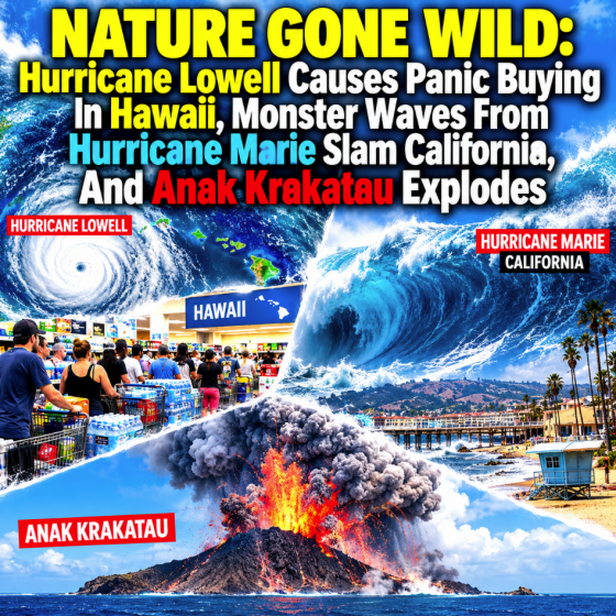
Three very dangerous hurricanes are churning in the eastern Pacific Ocean and Anak Krakatau has violently erupted. The cataclysmic 1883 eruption of the original Krakatau volcano was one of the loudest and most powerful volcanic eruptions ever recorded, and it significantly reduced global temperatures for an extended period of time. So when Anak Krakatau starts to cause chaos, everyone should be paying attention. Of course here in the United States people are much more concerned about the three enormous hurricanes that are looming dangerously close to U.S. territory.
On Monday morning, Accuweather was telling us that Hurricane Lowell would “come within 100 miles of the western islands of Hawaii”…
Following a path similar to Hurricane Iniki from September 1992, Lowell is forecast by AccuWeather meteorologists to make a right turn and come within 100 miles of the western islands of Hawaii.
As of Monday morning HST, Hurricane Lowell was a Category 3 hurricane moving northeast at 14 mph and was located about 405 miles southwest of Honolulu.
Hawaii Gov. Josh Green declared a state of emergency last Thursday due to the impending impacts for the islands.
That would have been bad enough.
But now CNN is reporting that the forecast has changed and now Hurricane Lowell is expected to “pass about 75 miles west of the more populous Kauai as a Category 2 storm Monday night through Tuesday morning”…
Lowell is a Category 3 hurricane as of early Monday morning, local time, with winds of 115 mph, traveling north-northeast at 14 mph, according to the National Hurricane Center.
Its outer rainbands were hitting as far east as Oahu — where a tropical storm watch is in effect — but all of the islands will be soaked as the storm approaches throughout the day.
And it’s expected to get closer than previously thought. The hurricane’s forecast track has shifted about 75 miles east and closer to Kauai and Niihau since Sunday morning. Lowell’s center is now forecast to make its closest pass about 75 miles west of the more populous Kauai as a Category 2 storm Monday night through Tuesday morning.
Residents of Hawaii certainly don’t want to hear that Lowell will “get closer than previously thought”.
So what if Lowell keeps drifting in that direction and ends up making a direct hit on the Hawaiian islands?
That could be catastrophic.
At this moment, panic buying has erupted on Kauai as Hurricane Lowell approaches.
At Home Depot, supplies of plywood and propane are rapidly disappearing…
Shoppers on Kauai have rushed to stock up, leaving empty shelves, dwindling supplies of plywood and no propane at one Home Depot, while long lines formed at Costco and gas pumps.
Greg, an Oahu resident who is visiting his family on Kauai, told local KITV: ‘I think it looks like everybody gathered those items already. Everybody is out. Just making sure that all those items are gathered and whatnot.’
This sort of thing always seems to happen whenever a major disaster is looming.
One local resident said that Costco “was just flooded with people”…
Meanwhile, another extremely large hurricane has been sending monster waves into the Southern California coastline…
Kiare Reis-Torres, a Kauai resident, told KITV, ‘I’ve never experienced this, but I know that when I went to Big Save yesterday, most of the shelves were empty.
‘And then I saw that Costco was just flooded with people. Everybody’s just trying to grab their supplies.’
Hurricane Marie is impacting the Southern California coastline with powerful swells and dangerous rip currents triggering flooding, water rescues, and a frantic effort to keep ocean water away from homes.
The storm, churning in the eastern Pacific off the coast of Baja California, is not expected to make landfall in the Golden State—but it is already hitting beaches spanning Los Angeles County to Orange County.
At Seal Beach on Saturday, ocean water surged into parking lots near the pier, flooding low-lying areas and trapping vehicles.
This wasn’t supposed to happen, but it is.
In Long Beach, gigantic waves caused by Hurricane Marie have transformed “scenic waterfront streets into treacherous, waterlogged disaster zones”…
Among the hardest-hit areas is the low-lying city of Long Beach, where massive ocean surges have turned scenic waterfront streets into treacherous, waterlogged disaster zones.
Dramatic videos circulating online show towering waves crashing directly over concrete barricades and swamping public beach paths. Waters breached low-lying properties on the Peninsula, inundating coastal homes and parking lots.
The footage of these waves that is being shared on social media is absolutely shocking.
Authorities rushed to build an emergency sand berm, but it was no match for the colossal waves that kept relentlessly rushing in…
In anticipation of the high surf, municipal crews worked tirelessly with heavy machinery to construct a massive emergency sand berm along the shoreline. However, the relentless force of the tide quickly overtopped and breached the barrier, allowing saltwater to pour into residential neighborhoods.
Describing the frightening scene, local Peninsula residents expressed helplessness as ocean water rushed toward their doorsteps.
“The water just kept coming over the top of the berm,” noted one long-time resident watching municipal pumps work furiously to clear the street. “No matter how high they built it, the ocean was just too big.”
Hurricane Marie is not anywhere close to shore, but it is still inflicting quite a bit of pain.
In fact, the Metrolink Pacific Surfliner railroad in San Clemente had to be shut down for repairs because swells from Hurricane
Marie had caused so much damage.
Monster swells from Hurricane Marie forced emergency repairs on Southern California’s scenic railroad route on Sunday.
A portion of the Metrolink Pacific Surfliner railroad in San Clemente is undergoing repairs, forcing service suspensions across parts of Orange County through Labor Day Monday.
A third major storm, Hurricane Karina, is not currently expected to be a serious threat but meteorologists continue to monitor it.
On the other side of the world, a massive eruption of Anak Krakatau that lasted for 25 hours forced the cancellation of hundreds of flights at Jakarta’s main international airport…
Ash from the eruption of Indonesia’s Mount Anak Krakatau wreaked havoc for aviation around the region over the weekend.
The volcanic eruption disrupted hundreds of flights at Jakarta’s main international airport, the second-busiest in Southeast Asia, with cancellations extending into Monday.
The volcano began a period of continuous eruption at 11:07 p.m. local time on Friday, according to a CNBC translation of a press release from Indonesia’s Ministry of Energy and Mineral Resources. The continuous eruption lasted about 25 hours before ending at 12:04 a.m. on Sunday.
This was a very large eruption of a very dangerous volcano.
As of a few hours ago, a total of seven airports in Indonesia were still closed…
Seven Indonesian airports–including two serving Jakarta–remained closed on Monday morning because of volcanic ash from eruptions at Mount Anak Krakatau, the transport minister said.
Ash from Anak Krakatau, which sits halfway between Java and Sumatra islands, has blanketed Jakarta and several surrounding areas since it erupted late on Friday, leading to the closure of the airports for safety reasons.
The transport ministry said 170,000 people have been affected by flight cancellations.
Unfortunately, Anak Krakatau is not the only volcano in Indonesia that is rumbling right now.
At this stage, there are six different volcanoes in the country that are “at the second-highest alert status”…
Six active volcanoes in Indonesia are currently at the second-highest alert status, including Mount Anak Krakatau, Mount Lewotobi Laki-laki in East Nusa Tenggara, Mount Merapi in Yogyakarta, Mount Semeru in East Java, Mount Sinabung in North Sumatra and Lewotolok Volcano in East Nusa Tenggara.
Over the past several months, we have witnessed so much unusual seismic activity all over the globe.
Personally, I am convinced that this is just the beginning.
On top of everything else, an asteroid that was only discovered about 7 hours in advance just hit our planet…
Asteroid 2026 RW1 struck Earth over the Indian Ocean northwest of Australia on September 6, just over 7 hours after it was discovered, becoming the 13th known asteroid detected before hitting Earth. This event added another real-world test of planetary defense systems designed to identify small incoming objects, rapidly refine their trajectories, and determine where and when they will enter the atmosphere.
ESA tracked the asteroid under the temporary identifier CERNQ52 using its Meerkat system and estimated its diameter at only 0.6–1.3 m (2–4.3 feet). Objects of this size are difficult to detect far in advance because they are intrinsically faint, often becoming observable only when they are already relatively close to Earth.
In many other instances, astronomers only spotted a large space rock once it had already flown past us.
We are far more vulnerable than most people realize.
Despite all of our advanced technology, we are very much at the mercy of the natural world.
Unfortunately for all of us, the natural world continues to become even more unstable all around us.
Michael’s new book entitled “10 Prophetic Events That Are Coming Next” is available in paperback and for the Kindle on Amazon.com, and you can subscribe to his Substack newsletter at michaeltsnyder.substack.com.
Nature Gone Wild: Hurricane Lowell Causes Panic Buying In Hawaii, Monster Waves From Hurricane Marie Slam California, And Anak Krakatau Explodes
If you're gonna fight, fight like you're the third monkey on the ramp to Noah's Ark... and brother its starting to rain. Join our efforts to Secure America's Borders and End Illegal Immigration by Joining ALIPAC's E-Mail Alerts network (CLICK HERE)
-
09-08-2026, 12:31 PM #214Super Moderator
- Join Date
- Feb 2024
- Posts
- 4,428
Lake Mead DROPS To 26% - Water So LOW Sunken Boats Can Now Be Seen
Credits:
Channel: Crisis Radar
Published: 9/8/26
23:40 minutes
Last edited by GaiaGoddess; 09-08-2026 at 12:44 PM.
-
09-08-2026, 12:46 PM #215Super Moderator
- Join Date
- Feb 2024
- Posts
- 4,428
Asia's DEADLIEST Volcano Just ERUPTED AGAIN - Killed 36,417 Before, Now Is Awaken Again
Credits:
Channel: Crisis Radar
Published: 9/8/26
23:19 minutes
-
09-08-2026, 12:51 PM #216Super Moderator
- Join Date
- Feb 2024
- Posts
- 4,428
Hurricane Lowell approaches Kauaʻi County with destructive winds, flooding, storm surge and tornado threat, Hawaii
ByTeo Blašković
Tuesday, September 8, 2026 08:09 UTC
Follow us on Google News
Flooding and transportation disruptions were already affecting Kauaʻi late September 7, 2026, as Hurricane Lowell moved toward the island with maximum sustained winds of 175 km/h (110 mph). The hurricane was about 215 km (135 miles) southwest of Līhuʻe at 20:00 HST (06:00 UTC on September , with its core forecast to pass near or just west of Niʻihau overnight.

Satellite image of Hurricane Lowell at 03:40 UTC on September 8, 2026. Credit: NOAA/GOES-West, RAMMB/CIRA, The Watchers
Hurricane Lowell was moving north-northeast toward the western Hawaiian Islands at 30 km/h (18 mph) at 20:00 HST on September 7 (06:00 UTC on September, according to the National Hurricane Center (NHC) and Central Pacific Hurricane Center.
At the time, its center was located about 215 km (135 miles) southwest of Līhuʻe and 335 km (210 miles) west of Honolulu. The system had maximum sustained winds of 175 km/h (110 mph) and a minimum central pressure of 961 hPa.
A Hurricane Warning remained in effect for Kauaʻi County, including Kauaʻi and Niʻihau, while a Tropical Storm Warning covered Oʻahu. NHC forecast the core of Lowell to pass near or just west of Niʻihau overnight and early September 8 before the cyclone turns toward the northwest and slows after passing the main Hawaiian Islands.
Hurricane-force winds extended outward as far as 110 km (70 miles) from Lowell’s center, while tropical-storm-force winds extended as far as 280 km (175 miles). A station at Waimea on Kauaʻi’s south-central coast measured sustained winds of 79 km/h (49 mph) with a gust to 109 km/h (68 mph). Meanwhile, Līhuʻe Airport measured sustained winds of 64 km/h (40 mph) with a gust to 84 km/h (52 mph).

Hurricane Lowell NHC forecast track at 06:00 UTC on September 8, 2026. Credit: NWS/NHC
NHC forecast another 100–200 mm (4–8 inches) of rain across Kauaʻi, with maximum storm totals reaching 610 mm (24 inches) in isolated areas. Additional rainfall of 75–200 mm (3–8 inches) was forecast for the Big Island, with isolated storm totals reaching 305 mm (12 inches), while Oʻahu and Maui County were forecast to receive another 50–125 mm (2–5 inches) with isolated storm totals near 255 mm (10 inches).
The rainfall is expected to produce significant flash flooding and mudslides, particularly across Kauaʻi County and portions of the Big Island.

Hurricane Lowell WPC Rainfall Forecast September 7-9, 2026. Credit: NWS/WPC
 Satellite image of Hurricane Lowell at 03:40 UTC on September 8, 2026. Credit: NOAA/GOES-West, RAMMB/CIRA, The Watchers
Flooding was already affecting Kauaʻi before Lowell’s closest approach, with Kūhiō Highway near Hanalei Bridge closed after water covered the roadway. Kauaʻi County advised residents not to drive through flooded roads or around barricades.
Kauaʻi officials also closed or suspended a range of public facilities and services as conditions deteriorated. Līhuʻe Airport closed at 14:30 HST on September 7, regular refuse collection was suspended, county parks and campgrounds were closed, and regular Kauaʻi Bus operations were disrupted while buses supported transportation to refuge areas.
Emergency refuge areas were opened for residents unable to remain safely in coastal or other exposed locations. Kauaʻi’s Department of Water asked customers to conserve water because electrical failures affecting pumps and wells can interrupt supply or reduce pressure.
State and Kauaʻi County offices, public schools, Kauaʻi Community College and state judiciary facilities on the island were ordered closed on September 8, while essential government and emergency services remained operational.
NHC forecast storm-surge inundation of 0.6–1.2 m (2–4 feet) above ground somewhere in Kauaʻi County if peak surge coincides with high tide, with the highest values expected along the south coast of Kauaʻi and on Niʻihau. Surge on Oʻahu was forecast to reach up to 0.3 m (1 foot) above ground in vulnerable areas.
 Hurricane Lowell Peak Storm Surge Forecast. Credit: NWS/NHC
Large waves were expected to accompany the surge near the storm’s track, increasing the coastal inundation hazard. NHC also warned that swells generated by Lowell would continue producing life-threatening surf and rip-current conditions across portions of the Hawaiian Islands for several days.
Several tornadoes are possible near Kauaʻi and Niʻihau through the overnight period, with a few possible elsewhere across the Hawaiian Islands, NHC said.
The National Weather Service (NWS) office in Honolulu issued Hawaii’s first-ever Tornado Watch at 16:13 HST on September 7 (02:13 UTC on September 8th, as Lowell approached Kauaʻi. Tornado Watch 1 covered all of Kauaʻi County, including Līhuʻe, and remains in effect until 04:00 HST (14:00 UTC) on September 8.
The watch was later extended across the adjacent coastal waters, including the Kauaʻi Northwest Waters, Kauaʻi Windward Waters, Kauaʻi Leeward Waters and Kauaʻi Channel. NWS said atmospheric conditions were favorable for tornadoes in and close to the watch area and advised residents to monitor later statements and possible warnings.
Tropical-storm conditions were expected across Oʻahu overnight into September 8. NHC forecast additional rainfall there and warned that strong wind gusts, particularly in higher terrain, could damage trees and disrupt electrical service.
Lowell is forecast to weaken during the following several days but remain a hurricane during its passage near the Hawaiian Islands overnight. NHC expects the cyclone to fall below hurricane intensity after it clears the islands, while uncertainty increases later in the forecast period as Lowell interacts with changing upper-level steering conditions.
References
1 Hurricane Lowell Intermediate Advisory Number 48A – NHC/CPHC – September 8, 2026
2 5 p.m., Sept. 7, County of Kauaʻi, Hurricane Lowell Update – County of Kauaʻi / Kauaʻi Emergency Management Agency – September 7, 2026
3 State and county offices, public schools, community college and judiciary facilities in Kauaʻi County to close Tuesday due to Hurricane Lowell – Hawaiʻi Emergency Management Agency – September 7, 2026
4 Tornado Watch 1 – NWS/Honolulu – September 7, 2026
Author profile
Articles

Teo Blašković
I'm a dedicated researcher, journalist, and editor at The Watchers. With over 20 years of experience in the media industry, I specialize in hard science news, focusing on extreme weather, seismic and volcanic activity, space weather, and astronomy, including near-Earth objects and planetary defense strategies. You can reach me at teo /at/ watchers.news.
Last edited by GaiaGoddess; 09-08-2026 at 12:55 PM.
-
09-08-2026, 04:01 PM #217Super Moderator
- Join Date
- Feb 2024
- Posts
- 4,428
Hurricane Lowell Devastates Hawaii: Kauai Flooded, 60,000+ Without Power & Roads Shut Down
Credits:
Channel: Severe Weather USA
Published: 9/8/26
18:04 minutes
-
09-09-2026, 02:44 PM #218Super Moderator
- Join Date
- Feb 2024
- Posts
- 4,428
Lake Michigan JUST Lost 45 Trillion Gallons—And There's A Hole In The Bottom
Credits:
Channel: Crisis Radar
Published: 9/9/26
21:18 minutes
Summary
Lake Michigan and Lake Huron fell below their long-term average in January 2026 for the first time in more than a decade, after losing nearly five feet of water since the record highs of 2020. Everyone blamed the weather. But the U.S. Army Corps of Engineers, NOAA and the International Joint Commission have all put a different cause on the record, and it sits at the bottom of the St. Clair River.
Lake Michigan and Lake Huron are hydrologically one lake, joined at the Straits of Mackinac, and the Army Corps of Engineers' Detroit District reports a single water level for "Lake Michigan-Huron." The lake peaked at a July record in 2020 after the wettest five-year stretch since the 1890s, then declined through dry autumns in 2023, 2024 and 2025. On January 9, 2026 the Corps reported that the Great Lakes had ended 2025 below average for the first time in a decade. A record April 2026 rise of 13.4 inches, the largest one-month rise since 1951, followed the wettest April in Wisconsin's history. The Corps' September 4, 2026 weekly bulletin puts Michigan-Huron at 579.30 feet, with seasonal declines forecast through the end of the year.
The St. Clair River, the lake's only outlet, was dredged for navigation between the 1850s and 1962, when the shipping channel was deepened to 27 feet. NOAA's Great Lakes Environmental Research Laboratory (Technical Memorandum GLERL-40, 1985), the International Joint Commission's International Upper Great Lakes Study (2009) and the IJC's April 26, 2013 recommendation all addressed what that dredging did to the lake. The Chicago diversion operates under a U.S. Supreme Court decree. The 2008 Great Lakes Compact governs diversions out of the basin; Waukesha, Wisconsin began drawing Lake Michigan water on October 9, 2023.
IN THIS VIDEO
• How much water actually left the lake between 2020 and 2026, measured in Lake Meads
• What the Corps' own hydrologist said in January about the pace of the decline, and what she admits they cannot measure
• The number the IJC's fact sheet puts on the dredging, and the two plugs that were promised and never built
• The Georgian Bay engineers who said the drain was bleeding 2.5 billion gallons a day, and what the $3.5 million study concluded
• Chicago's 2.1 billion gallons a day, the Supreme Court decree behind it, and the senator who asked about a pipeline west
• Why a 1,000-foot freighter cares about a single inch
• What the September bulletin says happens next
SOURCES
U.S. Army Corps of Engineers Detroit District (Weekly Great Lakes Water Level Update, Sept 4, 2026; Monthly Bulletin, August 2026 hydrology) · Indiana DNR Great Lakes water level table (1981–2026) · NOAA GLERL Technical Memorandum ERL GLERL-40 (Derecki, 1985) · NOAA GLERL (June 23, 2025) · International Joint Commission (Great Lakes Day Water Levels Fact Sheet; International Upper Great Lakes Study St. Clair River Summary Report, Dec 2009; news release Apr 26, 2013; "Controlling Water Levels on Lake Michigan-Huron," Oct 17, 2013) · WILX Lansing (Jan 9, 2026) · Great Lakes Now / Planet Detroit (Mar 10, 2026) · Urban Milwaukee / Wisconsin Public Radio (May 11, 2026; May 12, 2025) · Milwaukee Journal Sentinel (Dan Egan, July 30, 2013; Dec 17, 2009) · WaterWorld (Oct 4, 2007) · The Tiny Cottager (Oct 2005) · Michigan Public / AP (Apr 26, 2013) · CBS Chicago (Feb 6, 2013) · Illinois DNR Lake Michigan Water Allocation · Metropolitan Water Reclamation District of Greater Chicago · Wisconsin v. Illinois, 281 U.S. 179 (1930) · PBS Wisconsin / AP (Oct 10, 2023) · E&E News (Aug 25, 2022) · Governing / Chicago Tribune (Sept 11, 2024) · House Transportation & Infrastructure Committee, testimony of Jim Weakley (Dec 13, 2023) · Great Lakes Echo (May 14, 2014) · Dredging Today and Patch (Feb–Mar 2013) · Great Lakes Commission · U.S. Census Bureau · Bureau of Reclamation (Lake Mead capacity)
RELATED
Lake Michigan water level 2026 · Great Lakes water levels · Lake Huron dropping · St. Clair River dredging · Chicago diversion Lake Michigan · Great Lakes Compact · Lake Michigan-Huron record low 2013 · Georgian Bay water levels
Water levels cited are the most recent Army Corps of Engineers figures available at publication and change weekly.
#LakeMichigan #LakeHuron #GreatLakes #WaterCrisis #StClairRiver #Chicago #Michigan #Wisconsin #ArmyCorpsOfEngineers #Drought #CrisisRadar
Last edited by GaiaGoddess; 09-09-2026 at 02:59 PM.
-
09-09-2026, 02:52 PM #219Super Moderator
- Join Date
- Feb 2024
- Posts
- 4,428
Major Storms Hit Iowa: 70 MPH Winds, 19,500 Without Power & Major Flooding
Credits:
Channel: Severe Weather USA
Published: 9/9/26
20:03 minutes
-
09-10-2026, 01:34 PM #220Super Moderator
- Join Date
- Feb 2024
- Posts
- 4,428
What's Coming To Lake Mead Is Terrifying ... The Government Already Wrote It Down
Credits:
Channel: Crisis Radar
Published: 9/10/26
23:39 minutes


 Reply With Quote
Similar Threads
-
The dying of the West: Lake Mead and Lake Powell may not refill “in our lifetimes” wa
By Airbornesapper07 in forum Other Topics News and IssuesReplies: 1Last Post: 02-08-2023, 08:32 AM -
Hoover Dam, Lake Mead officers getting 52,000 rounds of ammo
By JohnDoe2 in forum Other Topics News and IssuesReplies: 1Last Post: 07-13-2015, 11:18 AM -
Boats roll on Strip to protest Lake Mead closure .... and so it begins
By AirborneSapper7 in forum General DiscussionReplies: 2Last Post: 10-08-2013, 03:01 PM -
Drought has Lake Mead at historic low
By JohnDoe2 in forum Other Topics News and IssuesReplies: 0Last Post: 11-01-2010, 01:36 PM -
Lake Mead sinks to a new historic low: Ariz. could experienc
By AirborneSapper7 in forum Other Topics News and IssuesReplies: 1Last Post: 10-20-2010, 03:37 AM


Illegal Alien Indicted by Federal Grand Jury for Numerous Crimes...
09-20-2026, 06:36 AM in Non-Citizen & illegal migrant voters